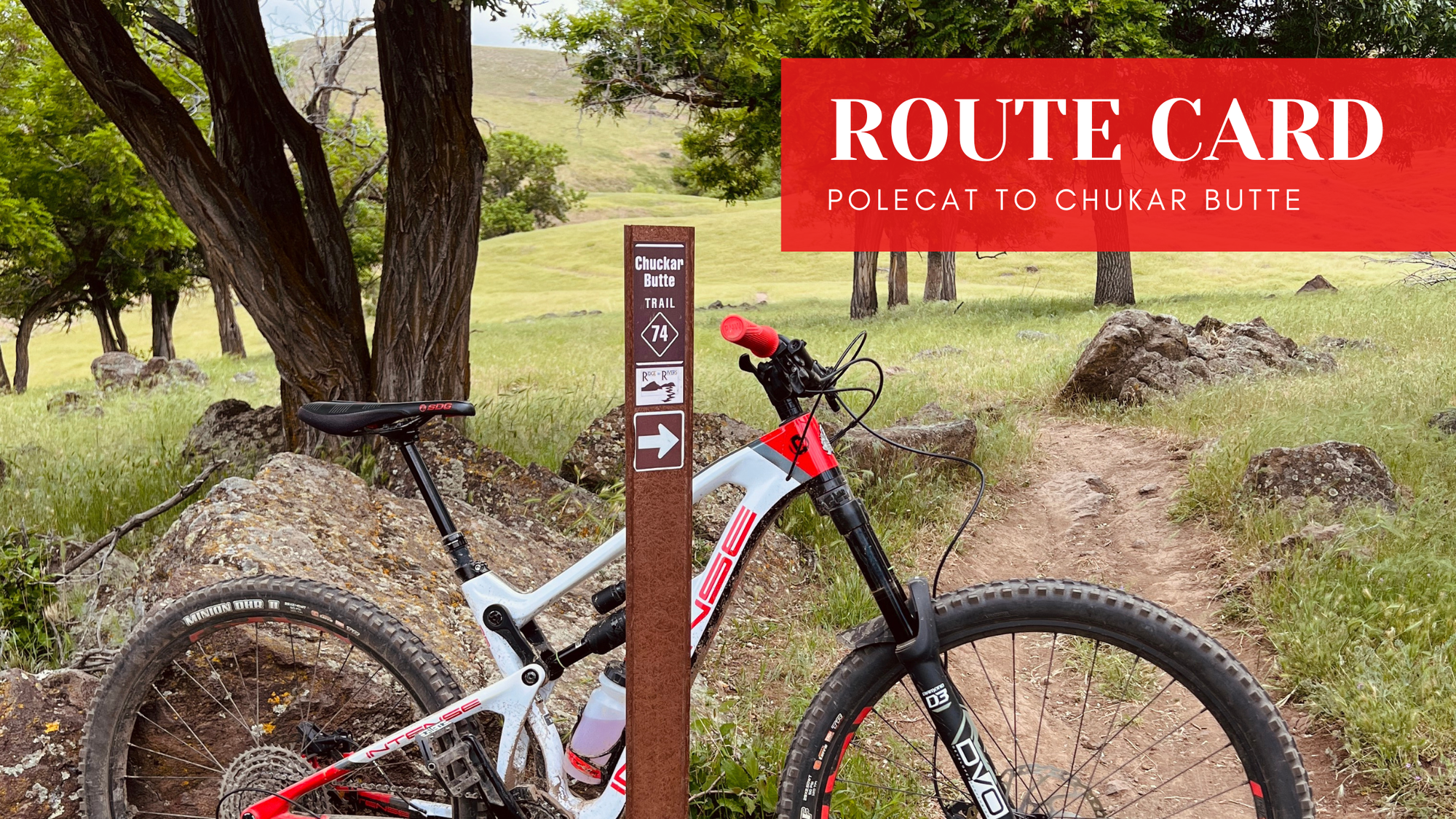
Route Card: Polecat to Chukar Butte

For the off season this year, I’m sharing a series of Route Cards pulled straight from my Strava history. These are routes I’ve ridden over the years, everything from quick after work loops to big days during the Trail Challenge, plus a few shuttle laps mixed in. The goal isn’t to over explain or turn these into full ride guides. It’s to give you simple, proven route ideas you can bookmark now and come back to when 2026 rolls around. Think of these as quick reference cards for exploring new areas, linking trails more confidently, and getting out of your normal riding routine.
Quick Stats
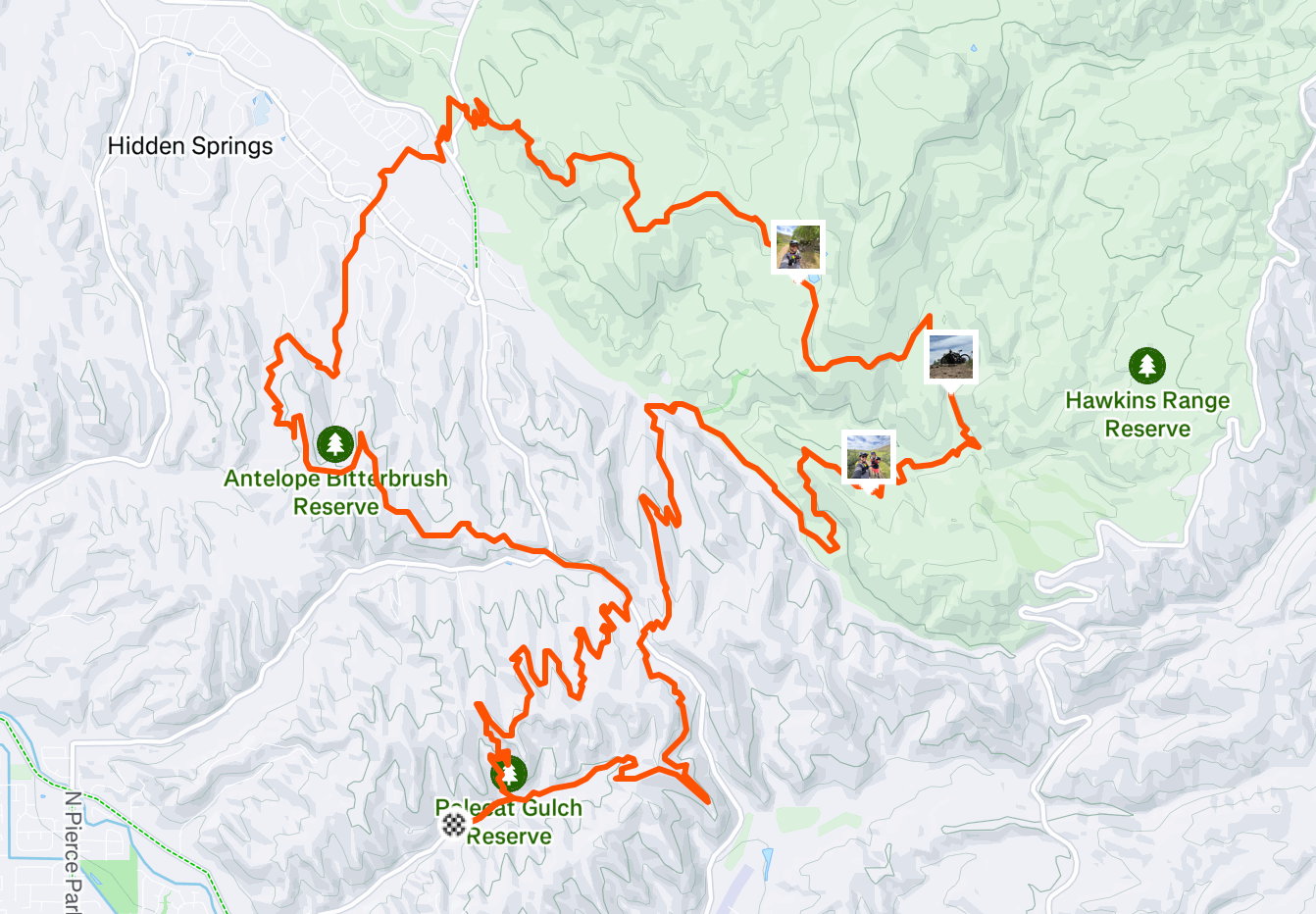
- Distance: 21.50 miles
- Elevation Gain: 2,450'
- Ride Time: 2 1\2 hours +
- Difficulty Level: Intermediate
- Strava Link
Route Snapshot
This is one of those loops that I did on impulse and it was so much fun. Probably because I just went for it. This ride is featured as a highlight on my instagram account if you're interested in checking out the story of the ride. Starting at lower Polecat does depend on the direction of that loop each year, you can also climb up Doe Ridge and over to the North parking lot, but just be sure to check Ridge to Rivers to see what direction they are running it each year.
This loop was me pushing myself as far as I could that year. For some of you this may be a very manageable ride, but for others, like myself, it might be all you got. So plan accordingly. One thing to note about this loop is that there is no bug out loop if you've realized this is more than you can handle. So know your limits before you start. Once you drop down Barn Owl trail into Hidden Springs, you're committed to the loop. At about the 10 mile mark you'll be about halfway done climbing, but be aware once you begin that climb up Chukkar Butte there is no other way back than to complete the loop.
I planned in a lunch stop and several long breaks for this ride. I ended up seeing a friend on the trail and chatting with them for 30 minutes or so. So the timeframe on strava is off a bit. But definitely plan in some breaks, especially if doing this ride during the summer. This portion of the foothills has little to no shade and it's a sure fire way to get roasted by the sun if you don't plan accordingly.
I'm sure I'll do this one again in 2026. It was a lot of fun looking back at this ride.
Simple Route Directions
- Start at Lower Polecat Parking Lot
- Climb out of Polecat over to Cartwright Ridge
- Descend Barn Owl into Hidden Springs
- Ride through Hidden Springs and over to Chukkar Butte trail
- Climb Chukkar Butte
- Descend to Sweet Connie
- Connect to Peggys
- Return to Polecat
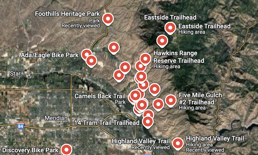
To make things even easier, I have created a public Google Maps guide with pins for every major Boise trailhead and bike park. It’s a simple way to see where to park and how to access the trails. Whether you're planning your first ride or looking for a new spot to explore, this guide has you covered.
More Route Cards are coming every week throughout January. This series is meant to be a growing library of ride ideas you can save, revisit, and pull from when you’re ready to explore something new in 2026. If you want these sent directly, subscribe to the Filthy Casual newsletter. That’s where I’ll be sharing new Route Cards, updates, and future ride projects first.
Forever Two Wheels!
-Myles